Seymour Arm Weather
Why use Revelstoke's weather?
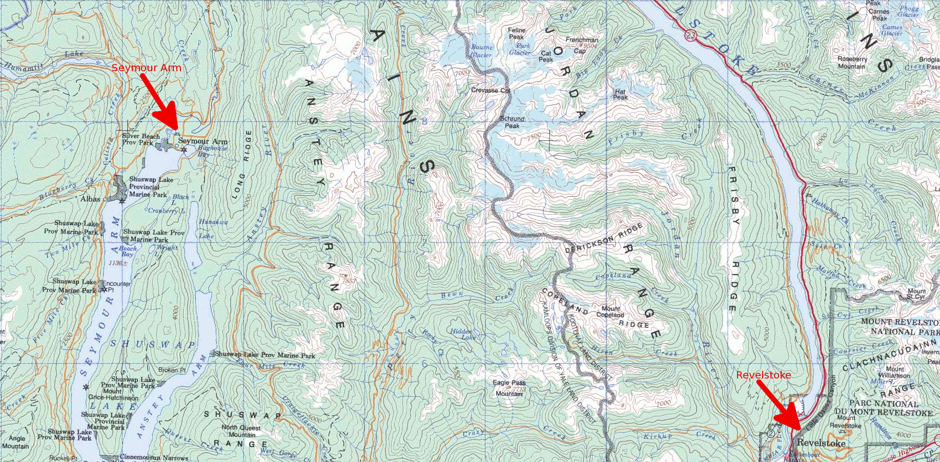
With many years of full-time living in Seymour Arm, I choose to depend on the Revelstoke, BC weather forecast.
Yes, we are in the Columbia-Shuswap Regional District, only a couple hundred kilometers north-east of Salmon Arm, and Kamloops is a little further west along the same latitude line as Salmon Arm, BUT…. we are on the northern most tip of the Shuswap Lake, tucked into the Monashee Mountain Range, which is actually part of the Columbia Mountains in southern British Columbia. Even 40 km down the road will lead you to a completely different weather pattern. Our weather tends to mimic that of Mount Revelstoke National Park. We are in part of the world’s only temperate inland rain forest.
Hmmm…. Maybe that’s why people look at me funny when I get to the desert city, Kamloops, wearing my rubber boots??
Kamloops, BC
Local Elevations
1,132 ft (345 m) ASL
Latitude
50° 40′ 34″ N
Longitude
120° 20′ 27″ W

